United Airlines Air Atlas 1967 UAL United States & Hawaii Route Maps

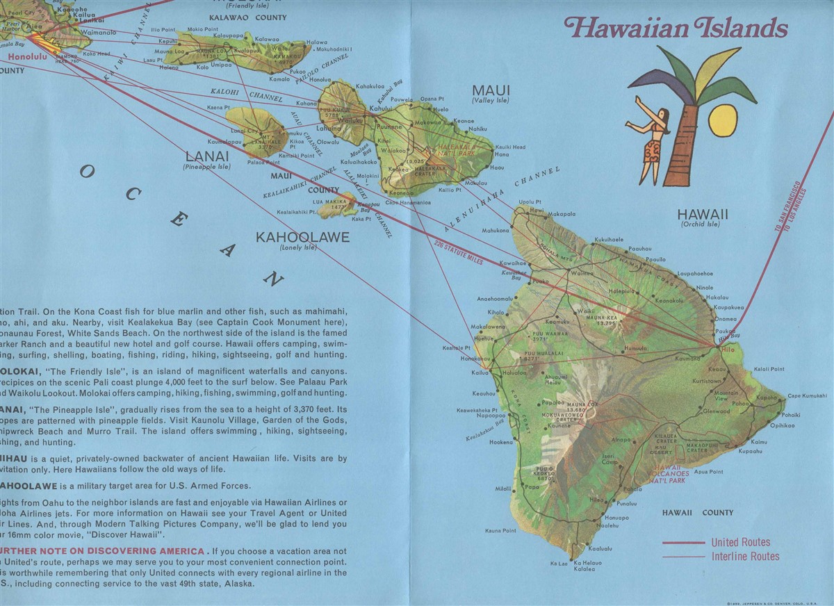
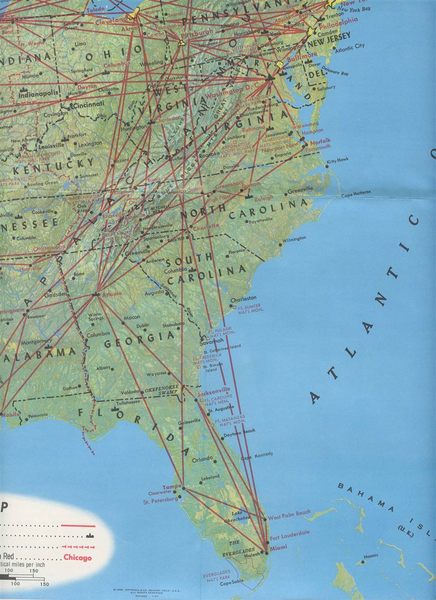
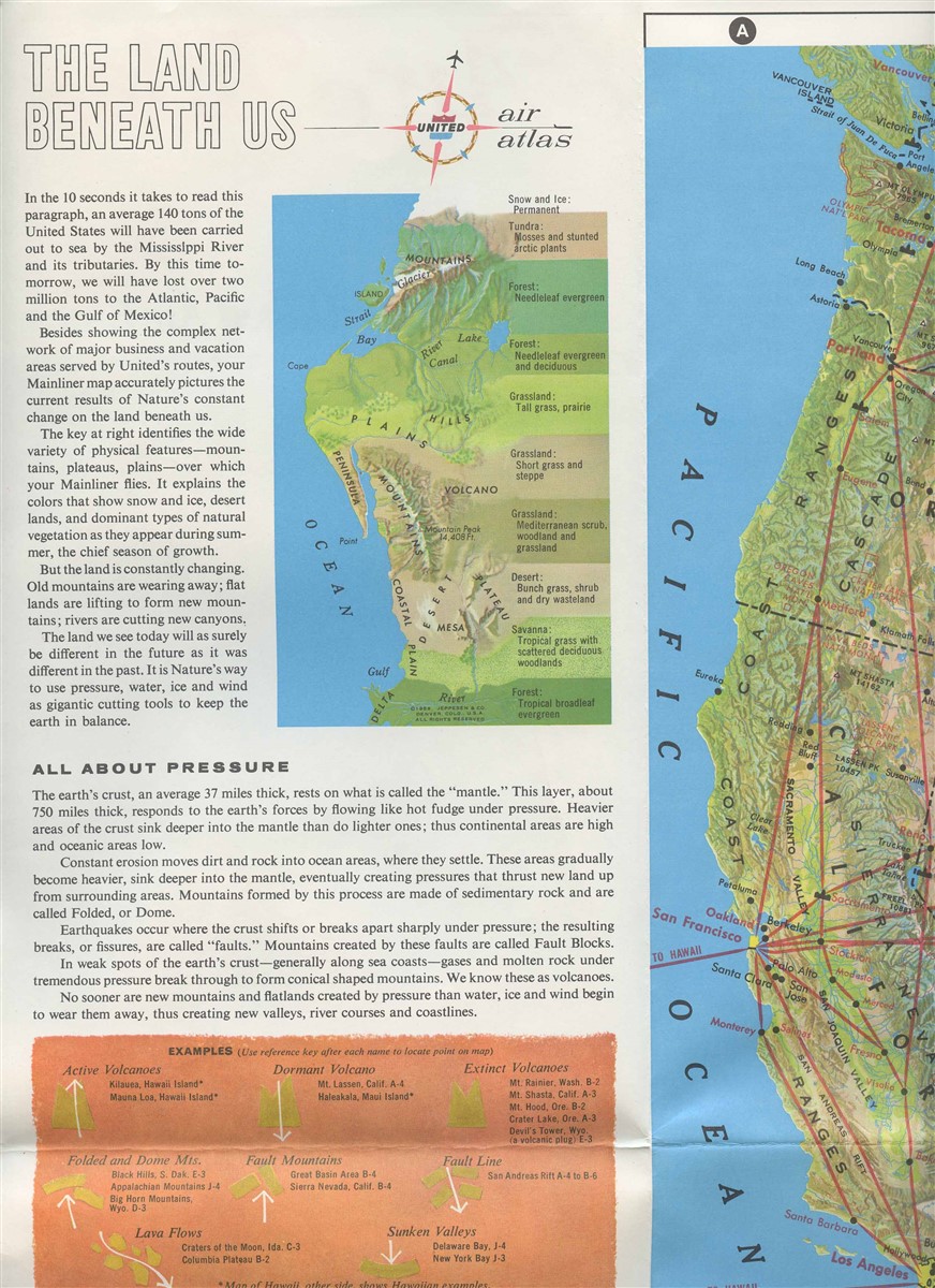
Opens to 36" x 21". On one side is a US map with the United routes overlaid. Also on this side is information on The LAnd Beneath Us, about pressure, water, ice, wind, sounds of an airplane flight and a knots to mph converter. On the other side is information on all of the cities United flew to with distances. With Points of Historical Interest, National Parks, Industry, Longest Rivers, Highest Mountains and much more. And a map of the Hawaiian Islands and United Routes. Dated 1967
in fine collectible conditionOur Policies:
For Multiple Purchases A single payment for all items would be appreciated.
We Ship World Wide Due to the Impact of USPS Policy Changes, Delivery time of some International Packages may be 8 to 18 weeks or more
International Buyers – Please Note:
Import duties, taxes, and charges are not included in the item price or shipping cost. These charges are the buyer's responsibility.
Please check with your country's customs office to determine what these additional costs will be prior to bidding or buying.
STATE Sales Tax Based on Applicable Tax Laws, will calculate and, collect Sales Tax for items shipped to customers in States requiring Sales Tax collection.
You may be interested in our other listings.
