Mount Holly New Jersey 1893 Hand Drawn Main Street Plat Map Catherine Merritt
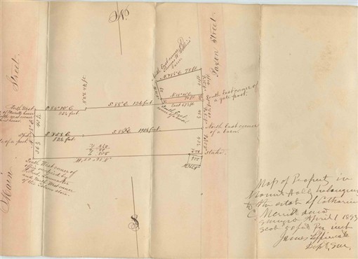
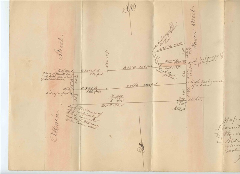
A Mount Holly New Jersey 1890 Hand Drawn Main Street Plat Map . Drawn on heavy stock. HAs been folded. Measures about 8 1/2" x 13 5/8" and the back is blank. With detailed measurement and landmarks notes. The streets have been colored. Says Map of Property in Mount Holly belonging to the estate of Catherine C Merritt deceased. Surveyed April 1, 1893. Scale 50 Feet per Inch, James Lippincote, Dept Sur.
in fine condition. has been foldedOur Policies:
For Multiple Purchases A single payment for all items would be appreciated.
We Ship World Wide Due to the Impact of USPS Policy Changes, Delivery time of some International Packages may be 8 to 18 weeks or more
International Buyers – Please Note:
Import duties, taxes, and charges are not included in the item price or shipping cost. These charges are the buyer's responsibility.
Please check with your country's customs office to determine what these additional costs will be prior to bidding or buying.
STATE Sales Tax Based on Applicable Tax Laws, will calculate and, collect Sales Tax for items shipped to customers in States requiring Sales Tax collection.
You may be interested in our other listings.
