HISTORIX 2002 Zimbabwe Map Poster - 24x30 Inch Restored Map of Zimbabwe South Af
Shipping options
Seller handling time is 2 business days Details
This reflects the seller's handling time and may not include time spent in transit.
If you have questions about shipping, please contact the seller.
FREE via to United States
Return policy
Full refund available for DOAs
Details
- We guarantee our products and offer full refunds or exchange for defective items or items not as-described.
- Buyer must contact us within 30 days after receipt of shipment.
- The item must be received in the same condition as shipped.
- Items must be returned with all original packaging and accessories.
- Items must not be abused, modified or damaged by accident.
- A 20% restocking fee will be charged for returns
- Buyer is responsible for all return shipping and handling fees.
- Restocking and return shipping fees do not apply when item is returned as defective or because incorrect product was delivered.
Payment options
PayPal accepted
PayPal Credit accepted
Venmo accepted
PayPal, MasterCard, Visa, Discover, and American Express accepted
Maestro accepted
Amazon Pay accepted
Nuvei accepted
Item traits
| Category: |
Laminating Machines
|
| Quantity Available: |
8 in stock
|
| Condition: |
New
|
| MPN: |
ENMAP06712430
|
| UPC: |
705514889669
|
| EAN: |
0705514889669
|
| color: |
Natural
|
| binding: |
unbound
|
| format: |
unbound
|
| language: |
english
|
| manufacturer: |
HISTORIX
|
| Externally Assigned Product Identifier: |
0705514889669
|
| Bullet Point: |
View details
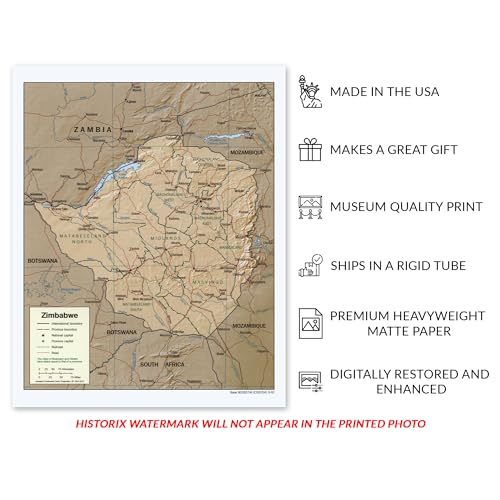
HISTORIC PRINTS: You’ll love this high quality print of 2002 Zimbabwe Map Poster. Our museum quality prints are archival grade, which means it will look great and last without fading for over 100 years. Our print to order maps are made in the USA ...
|
| Publication Date: |
2002T
|
| Product Description: |
View details
Zimbabwe is located in Southern Africa between the Zambezi and Limpopo rivers. Though it is landlocked, it remains a highly traveled tourist destination for its diverse ecology and distinctive culture. Zimbabwe's Iron Age began in the ninth cen...
|
| Brand: |
HISTORIX
|
| Unspsc Code: |
55101500
|
| Paper Finish: |
matte
|
| Map Scale: |
1000
|
| Item Name: |
View details
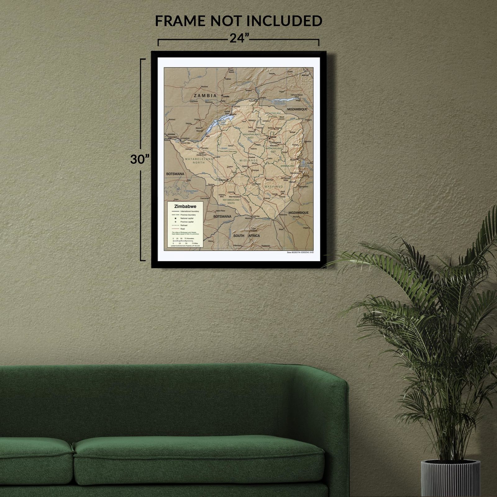
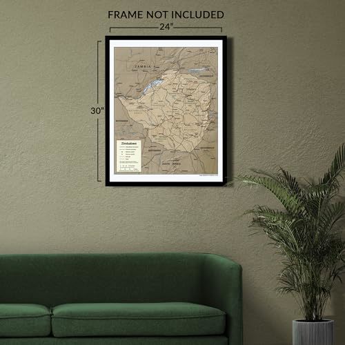
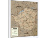
HISTORIX 2002 Zimbabwe Map Poster - 24x30 Inch Restored Map of Zimbabwe South Africa Wall Art Print - Zimbabwe South Africa Map Print
|
| Item Type Keyword: |
wall-maps
|
| Product Site Launch Date: |
2023-10-07T21:08:56.403Z
|
| Part Number: |
ENMAP06712430
|
Listing details
|
Seller policies:
|
View seller policies
|
|
Shipping discount:
|
Seller pays shipping for this item.
|
|
Posted for sale:
|
More than a week ago
|
|
Item number:
|
1735841285
|
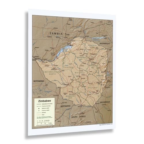
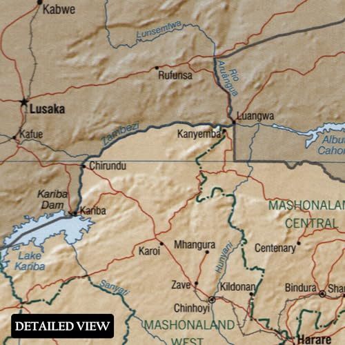
Zimbabwe is located in Southern Africa between the Zambezi and Limpopo rivers. Though it is landlocked, it remains a highly traveled tourist destination for its diverse ecology and distinctive culture. Zimbabwe's Iron Age began in the ninth century and was established by the Bantu people, who would go on to form the modern ethnic majority, the Shona. This map was produced by the United States Central Intelligence Agency, which keeps updated records of international boundaries and shifting geopolitical borders. These maps bear a distinctive aesthetic and unique minimal style that allows military and political leaders to develop and implement tailored policies and strategies.
By 2002, Zimbabwe had experienced considerable transformation following decades of authoritarian rule by President Robert Mugabe had allowed doe significant corruption in the federal government. Mugabe came to power in 1980 following a fifteen-year guerilla war by black nationalist forces and the government of Rhodesia. Mugabe's administration experienced numerous sanctions from Western nations for their policies, including land seizures that were implemented in an attempt to redistribute wealth from the minority land owners to minority groups who felt they had been underrepresented during the colonial eras of the past two centuries.
CIA maps were previously unavailable to the public and have become essential pieces of modern cartographical history that illustrate the evolution of international borders. This map shows the country in one of its periods of hardship before nearly a third of the residents fled due to an economic collapse that has influenced the country's politics since.
Additional Details
------------------------------
Bullet point: HISTORIC PRINTS: You?ll love this high quality print of 2002 Zimbabwe Map Poster. Our museum quality prints are archival grade, which means it will look great and last without fading for over 100 years. Our print to order maps are made in the USA and each map is inspected for quality. Maps are great for education in the classroom. Maps also make for beautiful wall art in the home, study or office. A great gift for travelers or map enthusiasts.
Product description:
Zimbabwe is located in Southern Africa between the Zambezi and Limpopo rivers. Though it is landlocked, it remains a highly traveled tourist destination for its diverse ecology and distinctive culture. Zimbabwe's Iron Age began in the ninth century and was established by the Bantu people, who would go on to form the modern ethnic majority, the Shona. This map was produced by the United States Central Intelligence Agency, which keeps updated records of international boundaries and shifting geopolitical borders. These maps bear a distinctive aesthetic and unique minimal style that allows military and political leaders to develop and implement tailored policies and strategies.
By 2002, Zimbabwe had experienced considerable transformation following decades of authoritarian rule by President Robert Mugabe had allowed doe significant corruption in the federal government. Mugabe came to power in 1980 following a fifteen-year guerilla war by black nationalist forces and the government of Rhodesia. Mugabe's administration experienced numerous sanctions from Western nations for their policies, including land seizures that were implemented in an attempt to redistribute wealth from the minority land owners to minority groups who felt they had been underrepresented during the colonial eras of the past two centuries.
CIA maps were previously unavailable to the public and have become essential pieces of modern cartographical history that illustrate the evolution of international borders. This map shows the country in one of its periods of hardship before nearly a third of the residents fled due to an economic collapse that has influenced the country's politics since.
Format: wall_map