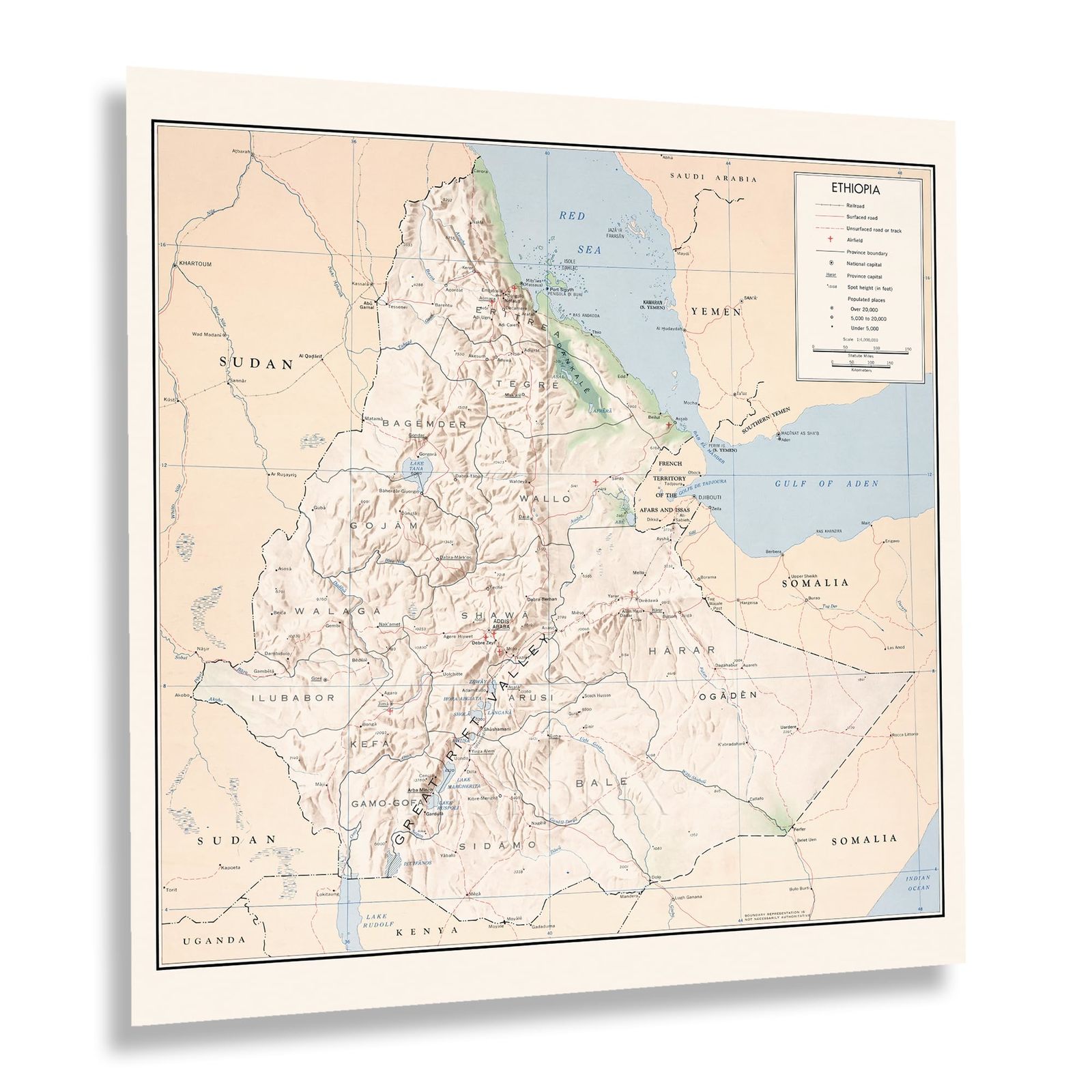
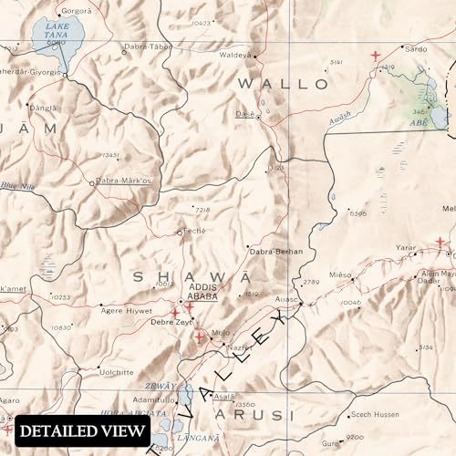
HISTORIX Vintage 1968 Ethiopia Map Print - 16x16 Inch Vintage Map of Ethiopia Po
Shipping options
Seller handling time is 2 business days Details
This reflects the seller's handling time and may not include time spent in transit.
If you have questions about shipping, please contact the seller.
FREE via to United States
Return policy
Full refund available for DOAs
Details
- We guarantee our products and offer full refunds or exchange for defective items or items not as-described.
- Buyer must contact us within 30 days after receipt of shipment.
- The item must be received in the same condition as shipped.
- Items must be returned with all original packaging and accessories.
- Items must not be abused, modified or damaged by accident.
- A 20% restocking fee will be charged for returns
- Buyer is responsible for all return shipping and handling fees.
- Restocking and return shipping fees do not apply when item is returned as defective or because incorrect product was delivered.
Payment options
PayPal accepted
PayPal Credit accepted
Venmo accepted
PayPal, MasterCard, Visa, Discover, and American Express accepted
Maestro accepted
Amazon Pay accepted
Nuvei accepted
Item traits
| Category: |
Laminating Machines
|
| Quantity Available: |
8 in stock
|
| Condition: |
New
|
| MPN: |
ENMAP06701616
|
| UPC: |
705514889638
|
| EAN: |
0705514889638
|
| color: |
Natural
|
| binding: |
unbound
|
| format: |
unbound
|
| language: |
english
|
| manufacturer: |
HISTORIX
|
| Externally Assigned Product Identifier: |
0705514889638
|
| Bullet Point: |
View details
VINTAGE MAP REPRODUCTION: You’ll love this high quality historic reproduction of 1941 Rio de Janeiro Map Print. Our museum quality prints are archival grade, which means it will look great and last without fading for over 100 years. Our print to o...
|
| Publication Date: |
1968T
|
| Product Description: |
View details
First settled by Portuguese explorers in 1565, Rio de Janeiro remains one of the most iconic cities in South America and is the second largest city in Brazil, following Sao Paulo. This map was produced in 1941 as the city was undergoing a perio...
|
| Brand: |
HISTORIX
|
| Unspsc Code: |
55101500
|
| Paper Finish: |
matte
|
| Map Scale: |
1000
|
| Item Name: |
View details
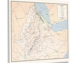
HISTORIX Vintage 1968 Ethiopia Map Print - 16x16 Inch Vintage Map of Ethiopia Poster Wall Art - History Map of Ethiopia East Africa Poster Print
|
| Item Type Keyword: |
wall-maps
|
| Product Site Launch Date: |
2023-10-07T20:42:23.666Z
|
| Part Number: |
ENMAP06701616
|
Listing details
|
Seller policies:
|
View seller policies
|
|
Shipping discount:
|
Seller pays shipping for this item.
|
|
Posted for sale:
|
More than a week ago
|
|
Item number:
|
1735840137
|
First settled by Portuguese explorers in 1565, Rio de Janeiro remains one of the most iconic cities in South America and is the second largest city in Brazil, following Sao Paulo. This map was produced in 1941 as the city was undergoing a period of significant transformation with architecture inspired by Paris and modern amenities as the nation continued to grow and develop following its colonial period. The city's famous Carnival celebrations remain an enduring attraction for hundreds of thousands of tourists annually, as well as the numerous beaches which have become synonymous with Rio de Janeiro and the iconic Copacabana hotel, which epitomized luxury during the mid-century era.
The city bears a distinct mix of indigenous and Portuguese traditions that have been blended since the first interactions of European settlers and have created a new culture that continues to evolve. Rio de Janeiro also has a predominately Catholic faith that has shaped and influenced the region for centuries and is reflected in the city's culture and politics. The city has long been known for disparities between social classes, and these rifts have created conflict, particularly in the middle portion of the twentieth century when this map was produced.
Rio is commonly divided into four quadrants, including the historic city center, which features some of the most iconic architecture and history in the city. This piece features a unique aesthetic and distinctive minimal style that transports the viewer back in time, and it is an authentic piece of cartographical history.
Additional Details
------------------------------
Bullet point: VINTAGE MAP REPRODUCTION: You?ll love this high quality historic reproduction of 1941 Rio de Janeiro Map Print. Our museum quality prints are archival grade, which means it will look great and last without fading for over 100 years. Our print to order maps are made in the USA and each map is inspected for quality. This beautiful artwork is a perfect addition to your themed decor. Vintage maps look great in the home, study or office. They make a perfect gift as well.
Product description:
First settled by Portuguese explorers in 1565, Rio de Janeiro remains one of the most iconic cities in South America and is the second largest city in Brazil, following Sao Paulo. This map was produced in 1941 as the city was undergoing a period of significant transformation with architecture inspired by Paris and modern amenities as the nation continued to grow and develop following its colonial period. The city's famous Carnival celebrations remain an enduring attraction for hundreds of thousands of tourists annually, as well as the numerous beaches which have become synonymous with Rio de Janeiro and the iconic Copacabana hotel, which epitomized luxury during the mid-century era.
The city bears a distinct mix of indigenous and Portuguese traditions that have been blended since the first interactions of European settlers and have created a new culture that continues to evolve. Rio de Janeiro also has a predominately Catholic faith that has shaped and influenced the region for centuries and is reflected in the city's culture and politics. The city has long been known for disparities between social classes, and these rifts have created conflict, particularly in the middle portion of the twentieth century when this map was produced.
Rio is commonly divided into four quadrants, including the historic city center, which features some of the most iconic architecture and history in the city. This piece features a unique aesthetic and distinctive minimal style that transports the viewer back in time, and it is an authentic piece of cartographical history.
Format: wall_map