HISTORIX Vintage 1892 Waco Texas Map Print - and 50 similar items


Free Shipping
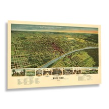
HISTORIX Vintage 1892 Waco Texas Map Print - 24x36 Inch Vintage Bird's Eye View
$59.99
View full item details »

Shipping options
Seller handling time is 2 business days Details
FREE via to United States
Return policy
Full refund available for DOAs
Details
Purchase protection
Payment options
PayPal accepted
PayPal Credit accepted
Venmo accepted
PayPal, MasterCard, Visa, Discover, and American Express accepted
Maestro accepted
Amazon Pay accepted
Nuvei accepted
View full item details »
Shipping options
Seller handling time is 2 business days Details
FREE via to United States
Return policy
Full refund available for DOAs
Details
Purchase protection
Payment options
PayPal accepted
PayPal Credit accepted
Venmo accepted
PayPal, MasterCard, Visa, Discover, and American Express accepted
Maestro accepted
Amazon Pay accepted
Nuvei accepted
Item traits
| Category: | |
|---|---|
| Quantity Available: |
8 in stock |
| Condition: |
New |
| MPN: |
ENMAP06802436 |
| UPC: |
705514890375 |
| EAN: |
0705514890375 |
| Paint Type: |
Watercolor |
| color: |
Natural |
| manufacturer: |
HISTORIX |
| Externally Assigned Product Identifier: |
0705514890375 |
| Item Shape: |
Rectangular |
| Bullet Point: | |
| Product Description: | |
| Brand: |
HISTORIX |
| Unspsc Code: |
55101500 |
| orientation: |
Landscape |
| Item Name: | |
| Item Type Keyword: |
wall-maps |
| Mounting Type: |
Wall Mount |
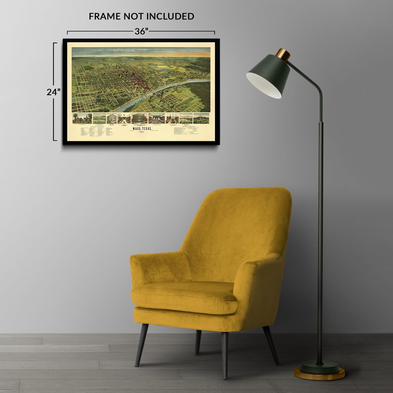
| size: |
36L" x 24W" |
| Part Number: |
ENMAP06802436 |
| style: |
Retro |
| Wall Art Form: |
poster |
| Target Gender: |
unisex |
Listing details
| Seller policies: | |
|---|---|
| Shipping discount: |
Seller pays shipping for this item. |
| Posted for sale: |
More than a week ago |
| Item number: |
1735832261 |
Item description
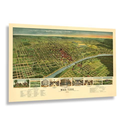
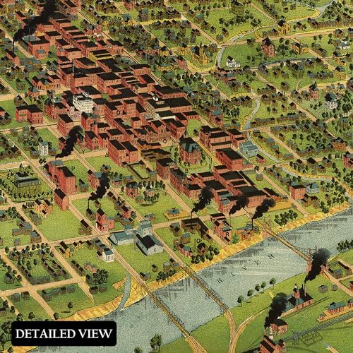
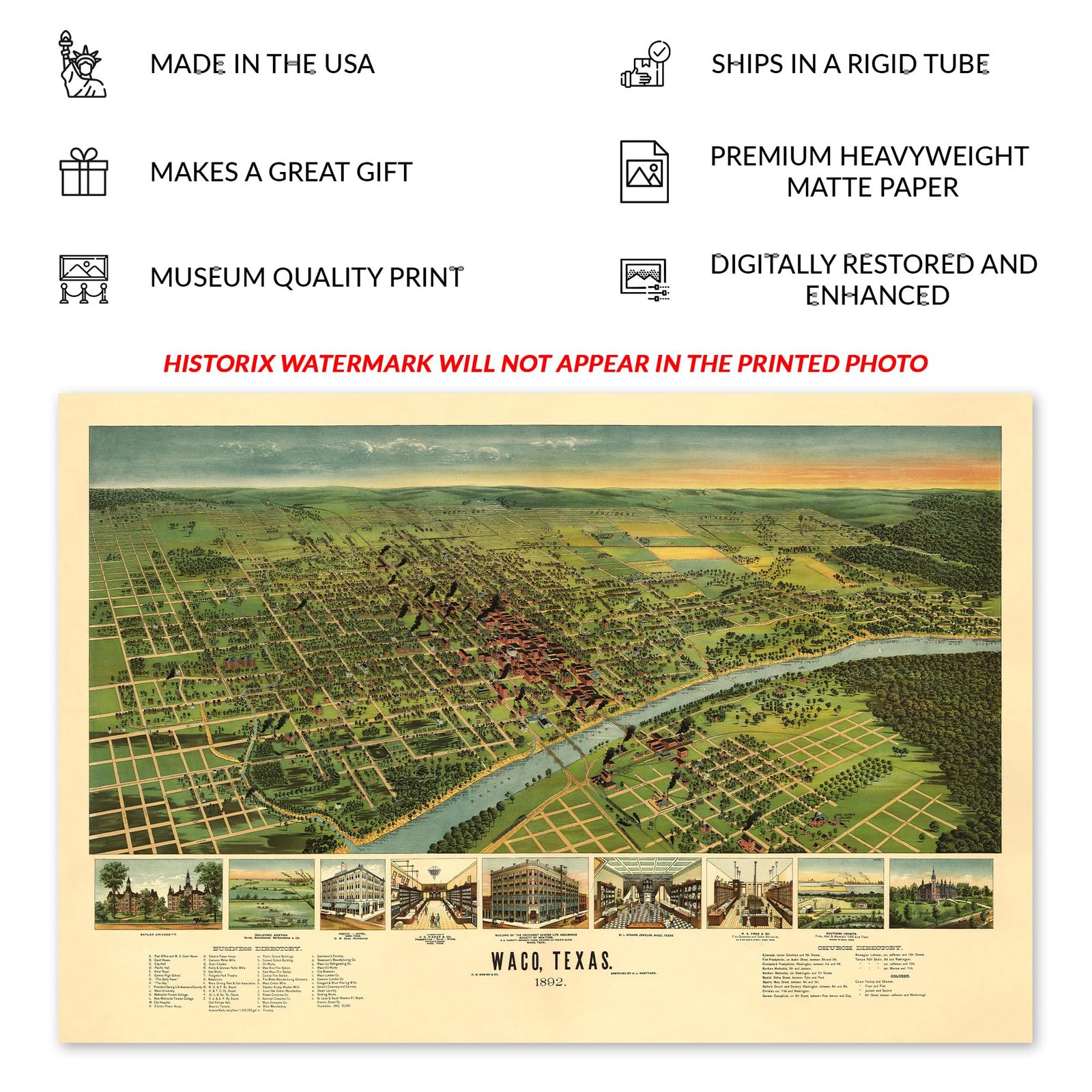
Located on the banks of the Brazos River, some halfway between Dallas and Austin, Texas, Waco has a rich history and remains one of the most iconic cities in the Lone Star State. During the time of this map's publication, the city and state were undergoing significant growth as the nation recovered from the Civil War. Demand for commodities like timber, cattle, and cotton grew, which were primary exports from the region. The Waco Suspension Bridge was completed in 1870, allowing the population to expand by allowing residents an easier way to cross the broad river and establish communities on the river's south bank.
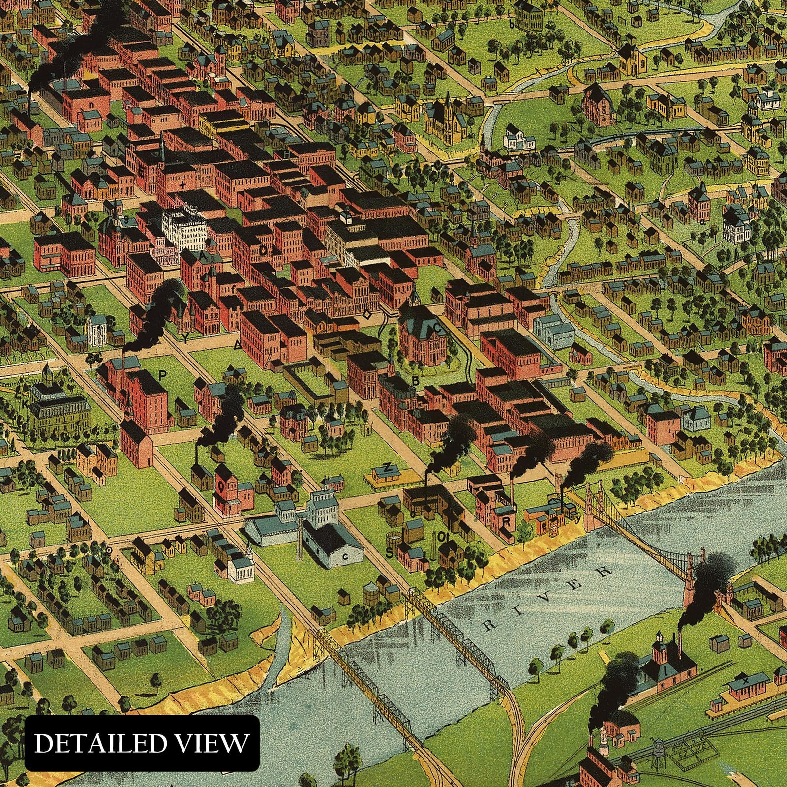
This bird's eye perspective bears a signature style widely popular during the nineteenth century. Panoramic maps were designed to entice residents and merchants alike to towns and cities across the United States by highlighting notable local features, economic institutions, places of worship, and other natural elements. They bear a distinctive aesthetic that is immediately recognizable and transports the viewer back in time, creating an indelible bond between the past and present. Bird's eye perspectives were often posted in train stations across the Northeast and South and were highly stylized but were not intended to be used for navigation.
This genuine piece of American cartographical history provides a glimpse into how Waco has evolved since the earliest homes were built. Baylor University was founded in 1845 and remains an iconic institute of higher education.
Additional Details
------------------------------
Bullet point: VINTAGE MAP REPRODUCTION: You?ll love this high quality historic reproduction of 1892 Waco Texas Map Print. Our museum quality prints are archival grade, which means it will look great and last without fading for over 100 years. Our print to order maps are made in the USA and each map is inspected for quality. This beautiful artwork is a perfect addition to your themed decor. Vintage maps look great in the home, study or office. They make a perfect gift as well.
Product description:
Located on the banks of the Brazos River, some halfway between Dallas and Austin, Texas, Waco has a rich history and remains one of the most iconic cities in the Lone Star State. During the time of this map's publication, the city and state were undergoing significant growth as the nation recovered from the Civil War. Demand for commodities like timber, cattle, and cotton grew, which were primary exports from the region. The Waco Suspension Bridge was completed in 1870, allowing the population to expand by allowing residents an easier way to cross the broad river and establish communities on the river's south bank.
This bird's eye perspective bears a signature style widely popular during the nineteenth century. Panoramic maps were designed to entice residents and merchants alike to towns and cities across the United States by highlighting notable local features, economic institutions, places of worship, and other natural elements. They bear a distinctive aesthetic that is immediately recognizable and transports the viewer back in time, creating an indelible bond between the past and present. Bird's eye perspectives were often posted in train stations across the Northeast and South and were highly stylized but were not intended to be used for navigation.
This genuine piece of American cartographical history provides a glimpse into how Waco has evolved since the earliest homes were built. Baylor University was founded in 1845 and remains an iconic institute of higher education.
|
Why are we showing these items?
Booth
Historic Prints |

|


-
Refine your browsing experience
We can show you more items that are exactly like the original item, or we can show you items that are similar in spirit. By default we show you a mix.
This item has been added to your cart
 HISTORIX Vintage 1892 Waco Texas Map Print - 24x36 Inch Vintage Bird's Eye View added to cart.
8 available in stock
HISTORIX Vintage 1892 Waco Texas Map Print - 24x36 Inch Vintage Bird's Eye View added to cart.
8 available in stock
View Cart or continue shopping.
 Please wait while we finish adding this item to your cart.
Get an item reminder
We'll email you a link to your item now and follow up with a single reminder (if you'd like one). That's it! No spam, no hassle.
Already have an account?
Log in and add this item to your wish list.